

ArcGIS Map Showcase: My Project Work from Introduction to GIS course
In this post I will lay out my project and assignment work from the course Intro to GIS at The George Washington University. I used ArcGIS software by ESRI to generate these maps.
Maps Series for Vietnam demographics in 1999:
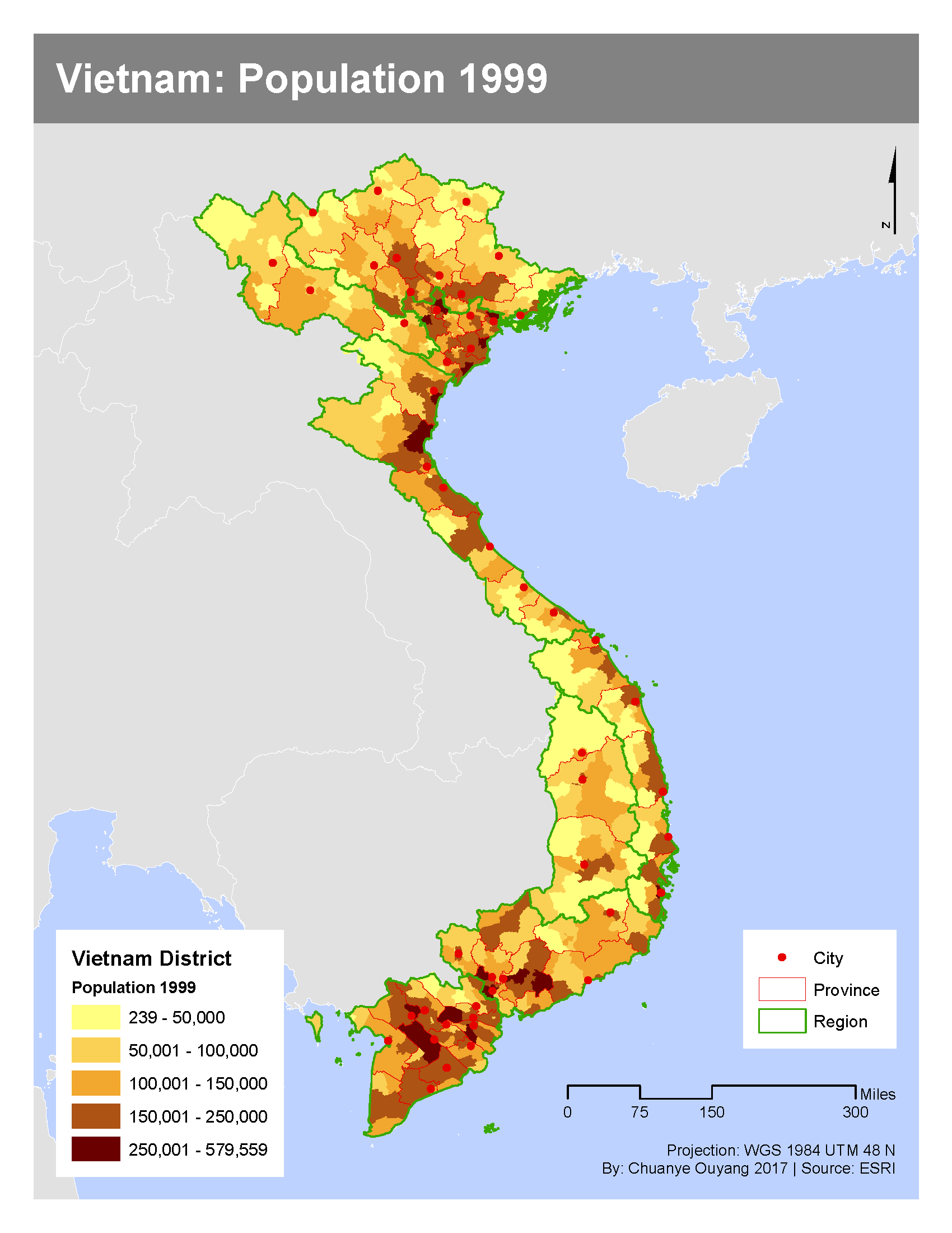
Vietnam: Population 1999
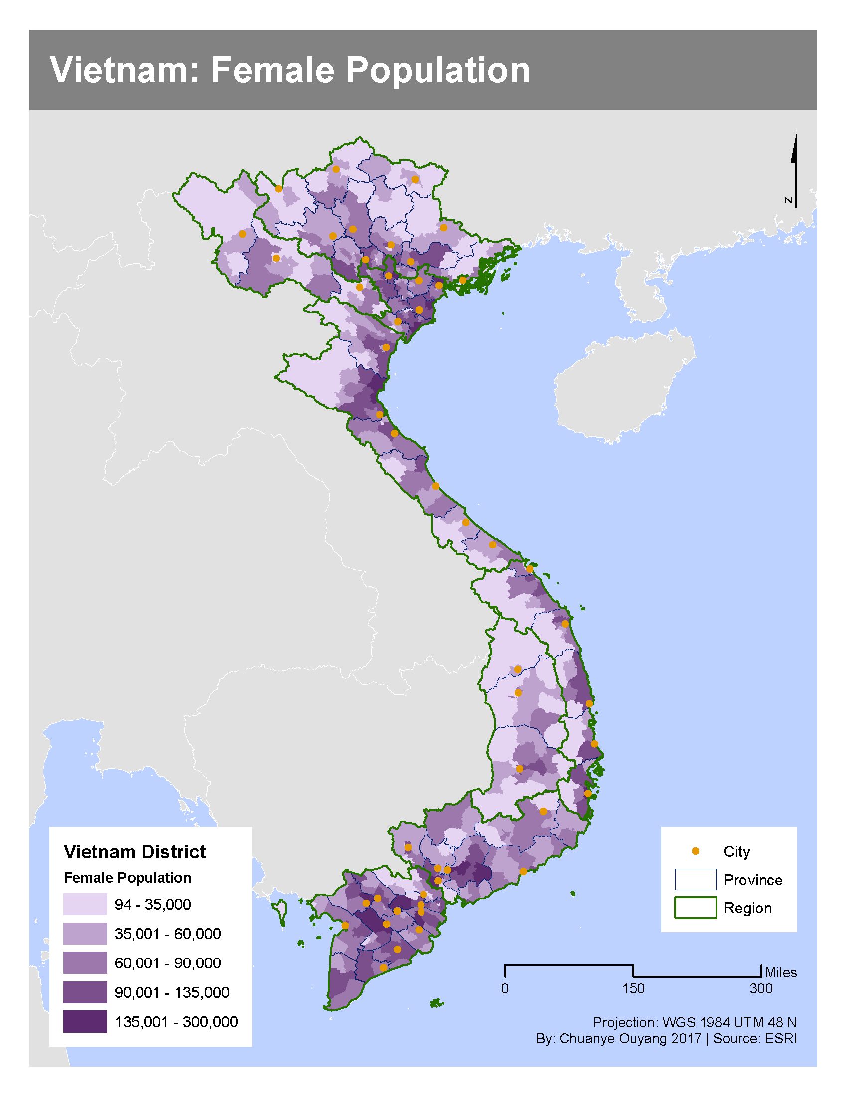
Vietnam: Female Population
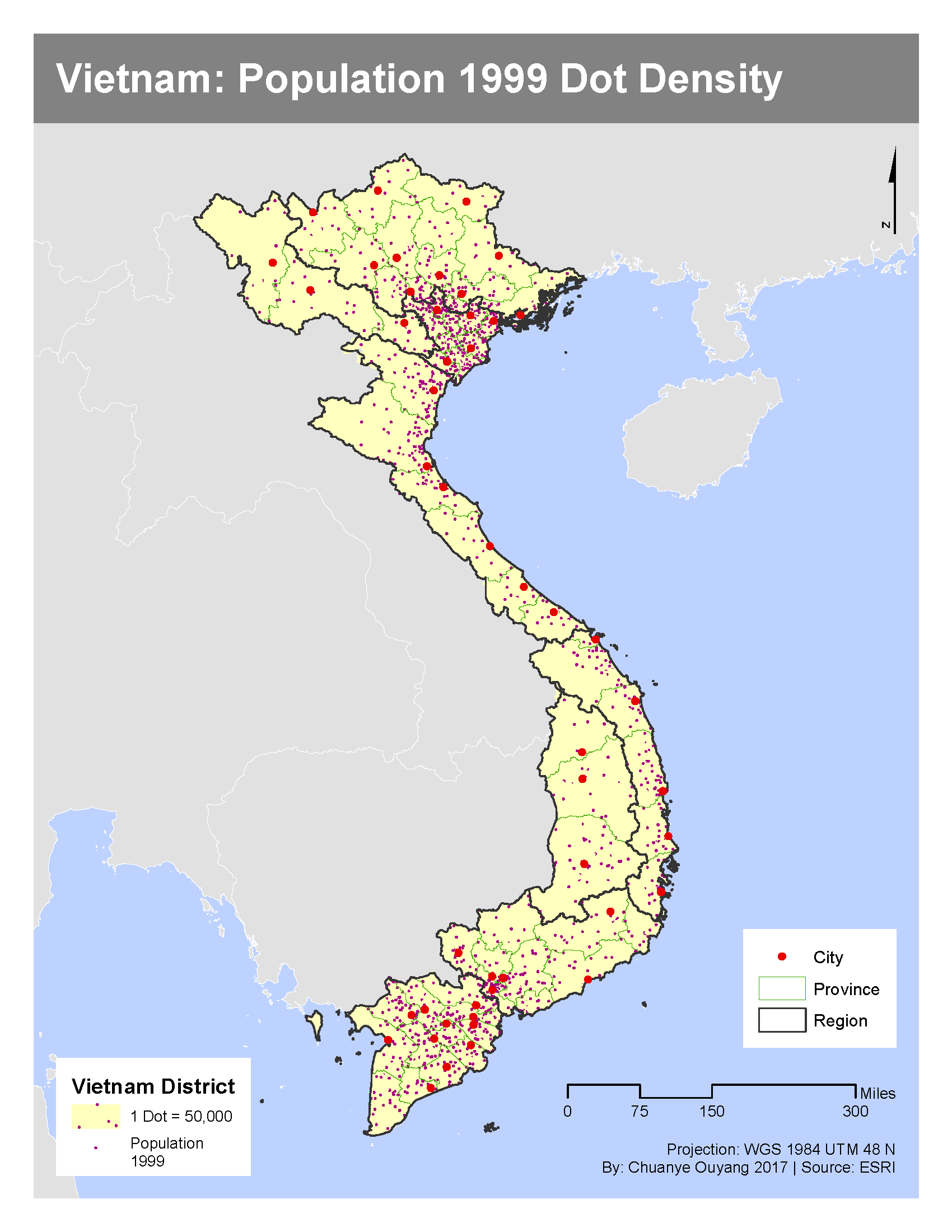
Vietnam: Population 1999 in Dot Density
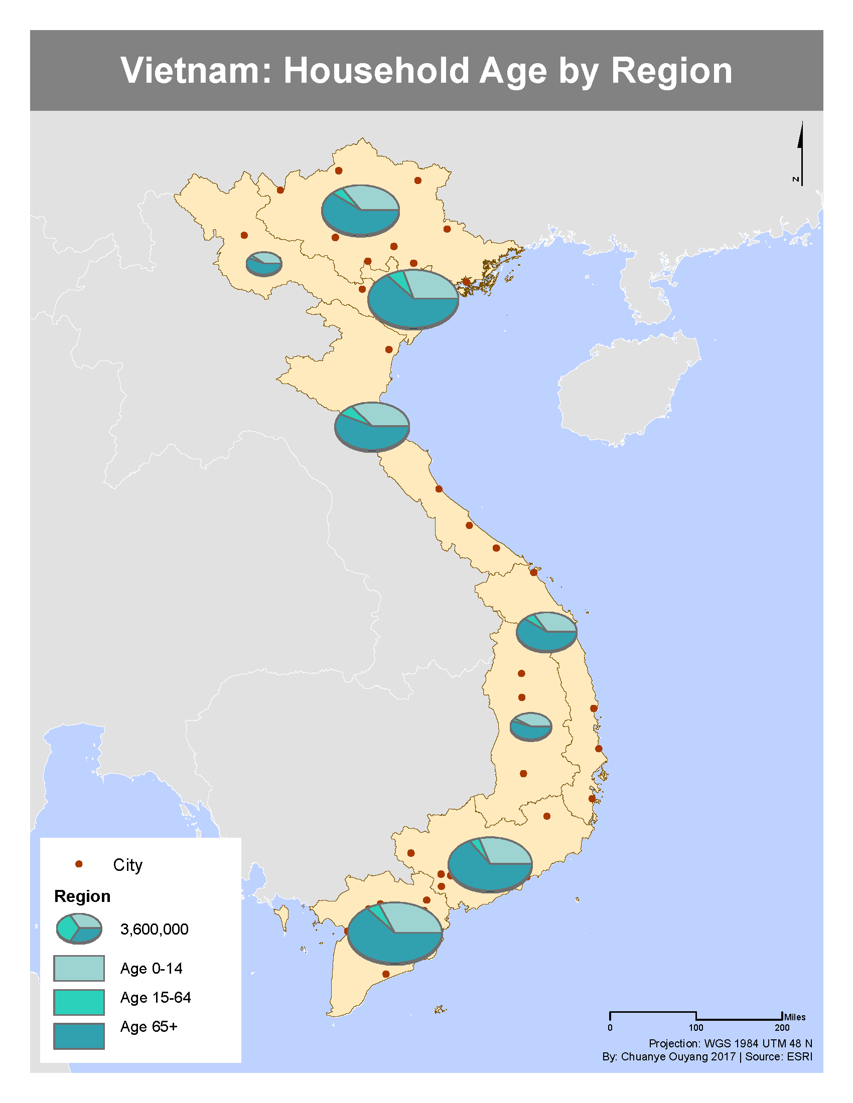
Vietnam: Household Age by Region
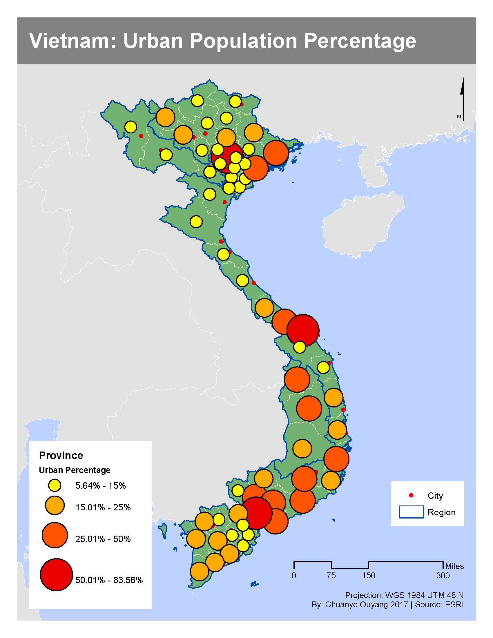
Vietnam: Urban Population Percentage
Mapping a region using geoprocessing techniques:
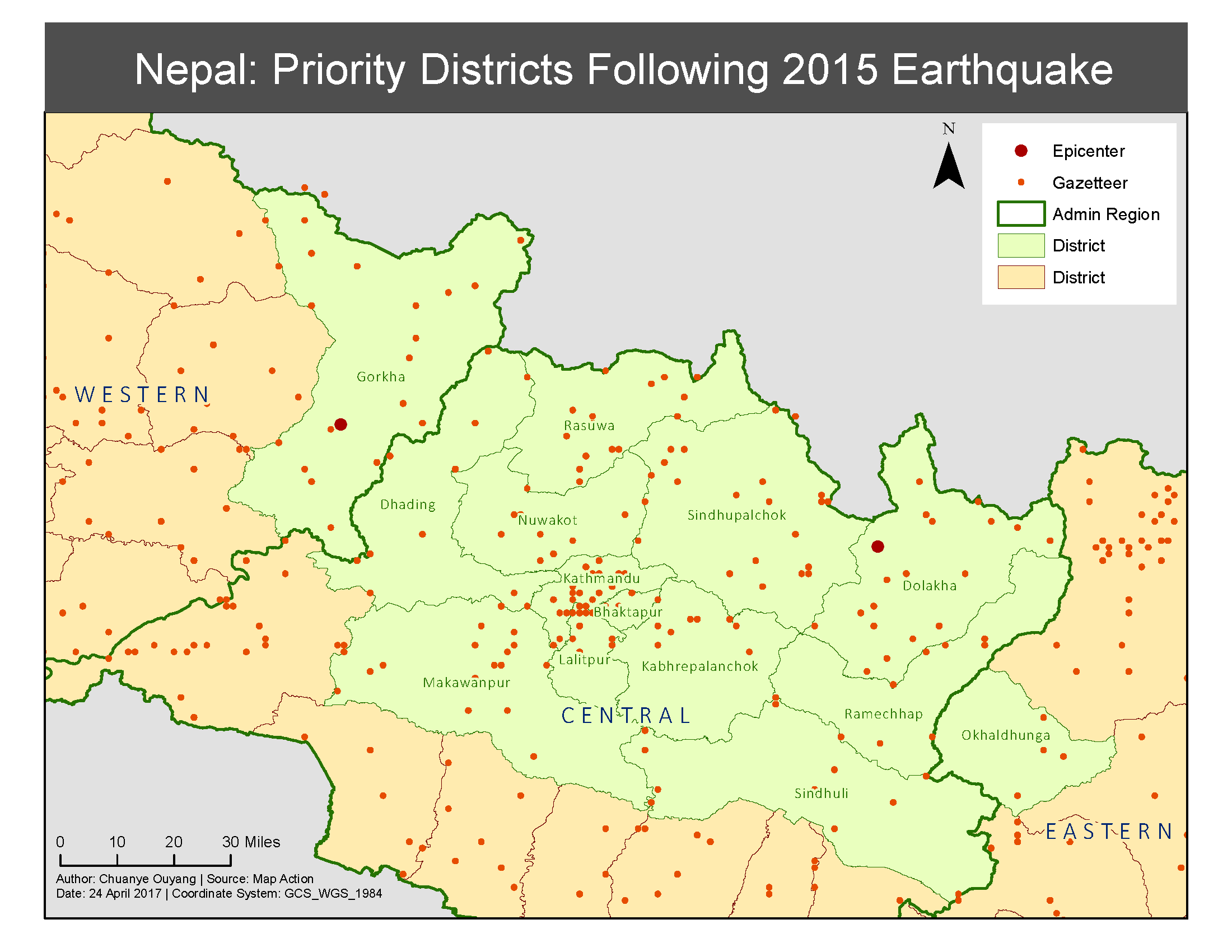
Nepal: Priority Districts in the Aftermath of 2015 Earthquake
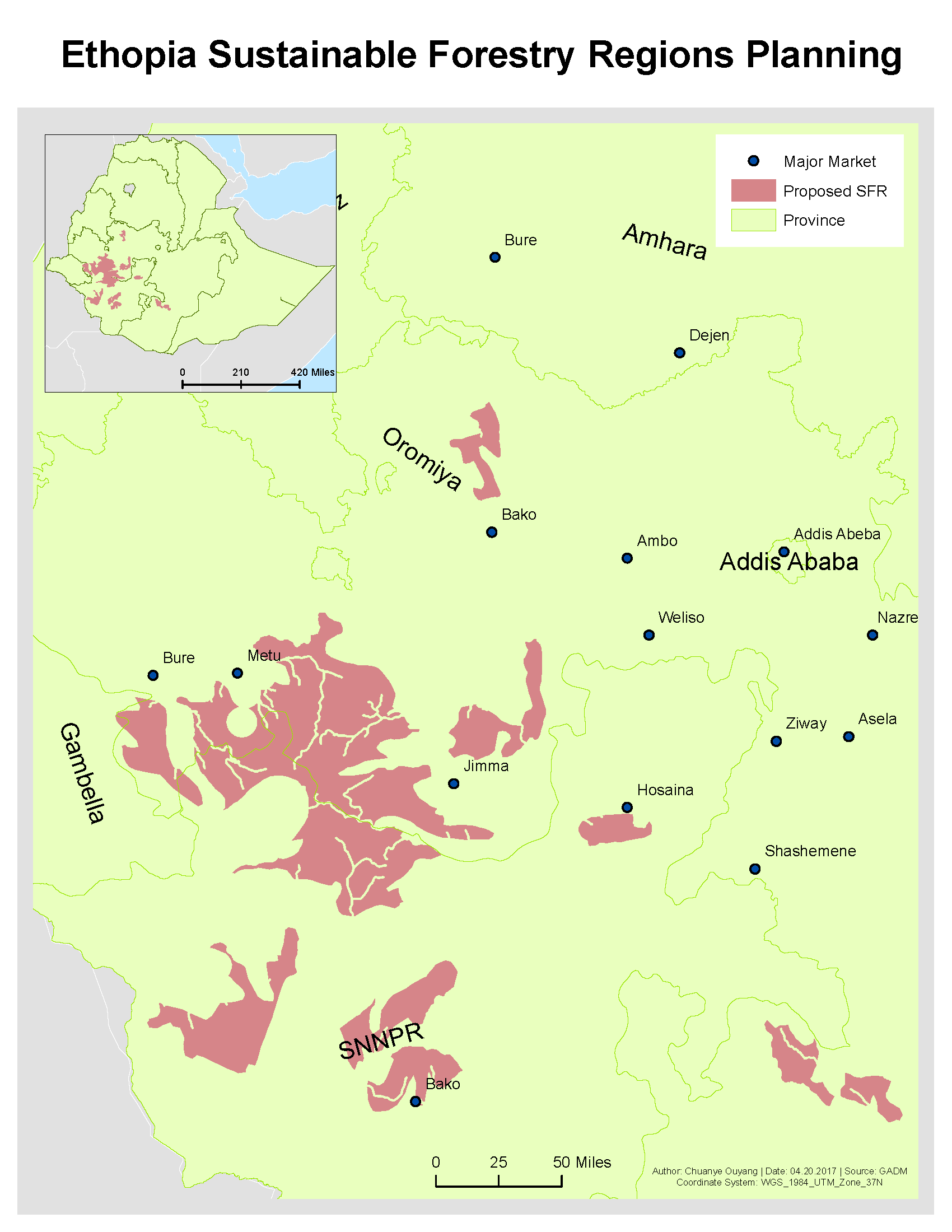
Ethopia: Sustainable Forest Regions Planning
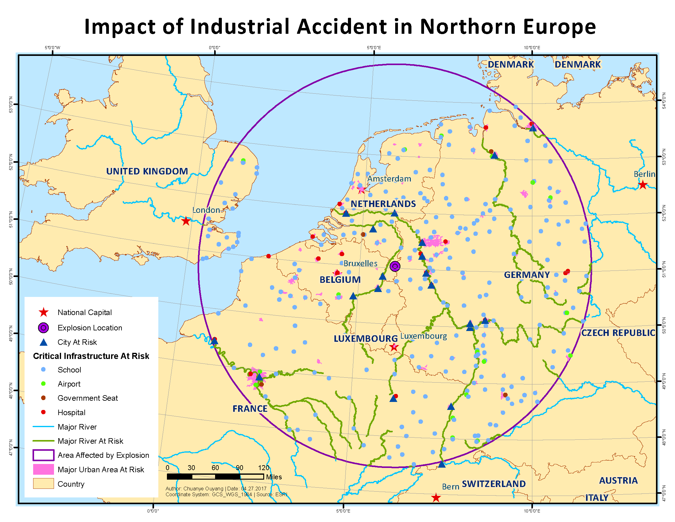
Northern Europe: Impact of Industrial Accident


Leave a Comment